

The Decolonisation of the World Map
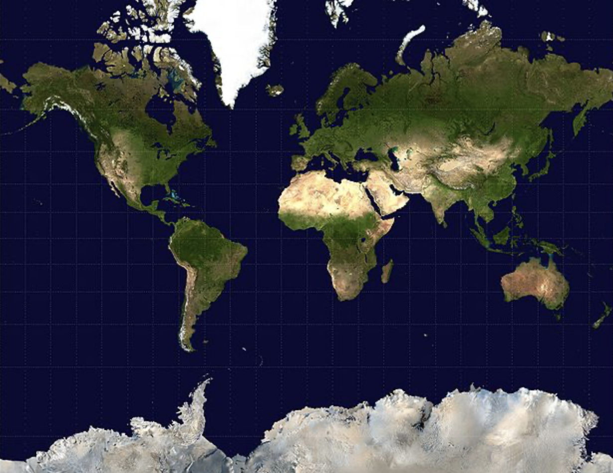
Mercators Projection
By Rose Chiara Atieno / GICJ
Decades since the beginning of the end of colonialism, Africa continues to be subject to a different form of colonialism, cartography inequality. Established in the 16th century, the Mercator’s projection has been the world’s most used 2D projection of what earth looks like, reflected in most accessible maps.. However, this projection showcases how colonial narratives continue to influence Western views of Africa by reinforcing outdated and reductive perspectives that reduce the size of the continent.
Neutrality of Maps: Maps As a Tool of Power
Maps have long been used as a tool of power, often skewed to favour Western powers by creating an image of greatness and strength in the world. Tools, such as cartography, are used to assert dominance, as famously witnessed in the Berlin Conference 1884-5 in which European powers apportioned the continent sans African representation. This projection in particular, does so by gravely undermining the reality of the continent's size in such a manner that Greenland seems to be identical in size, whereas in actuality, Africa is 14 times larger. Additionally, it exaggerates the size of the west to portray their power such as the exaggeration of the North American and European continent.
Change to the Current Map
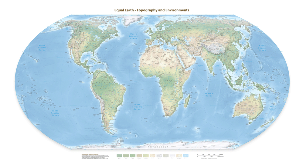
Equal Earth Projection
In response to this, two African NGOs, Africa No Filter and Speak Up Africa have taken it upon themselves to initiate the #CorrectTheMap campaign. This campaign urges states to cease the use of the Mercator projection and to adopt the Equal Earth projection. Notably, in August 2025, African Union has recently reaffirmed its support for this initiative, strongly advocating for the widespread recognition and adoption of a new map created in 2018 that accurately represents the true scale of the African continent.
Aside from presenting an accurate depiction of Africa, the importance of changing the map underscored by its role in reaffirming Africa’s rightful place on the global stage and shifting the colonialist perspective of what the continent represents. At the moment, the NGOs, with the support of the African Union, have urged the United Nations and the World Bank to adopt these changes. The World Bank has confirmed its use of a map based on the Equal Earth projection, signaling a shift towards more geographically accurate representations. Meanwhile, the UN has expressed a willingness to consider adopting the projection; however, the proposal must first be subject to a formal review process and a vote by member states.
Geneva International Centre for Justice (GICJ) strongly supports the African Union’s initiative to reject the Mercator’s projection, recognising it as a crucial step toward promoting a more accurate and equitable representation of Africa in global discourse. Additionally, GICJ recognises that the current projection continues to represent a time when Africa faced repression and mistreatment, thus we urge the international community to push for a change and adopt the Equal Earth projection.
Sources
Equal Earth Projection: https://www.geographyrealm.com/equal-earth-physical-map-free/
Mercator's Projection: https://rwu.pressbooks.pub/webboceanography/chapter/2-3-map-projections/
“African Union Urges Adoption of World Map Showing Continent’s True Size | Reuters.” Reuters, www.reuters.com/world/africa/african-union-urges-adoption-world-map-showing-continents-true-size-2025-08-14/
Archie, Ayana. “African Union Backs Campaign to Replace Mercator Map That Distorts Africa’s Size.” NPR, NPR, 21 Aug. 2025, www.npr.org/2025/08/21/nx-s1-5508358/mercator-map-africa
